Built by people who actually worked on the fields.
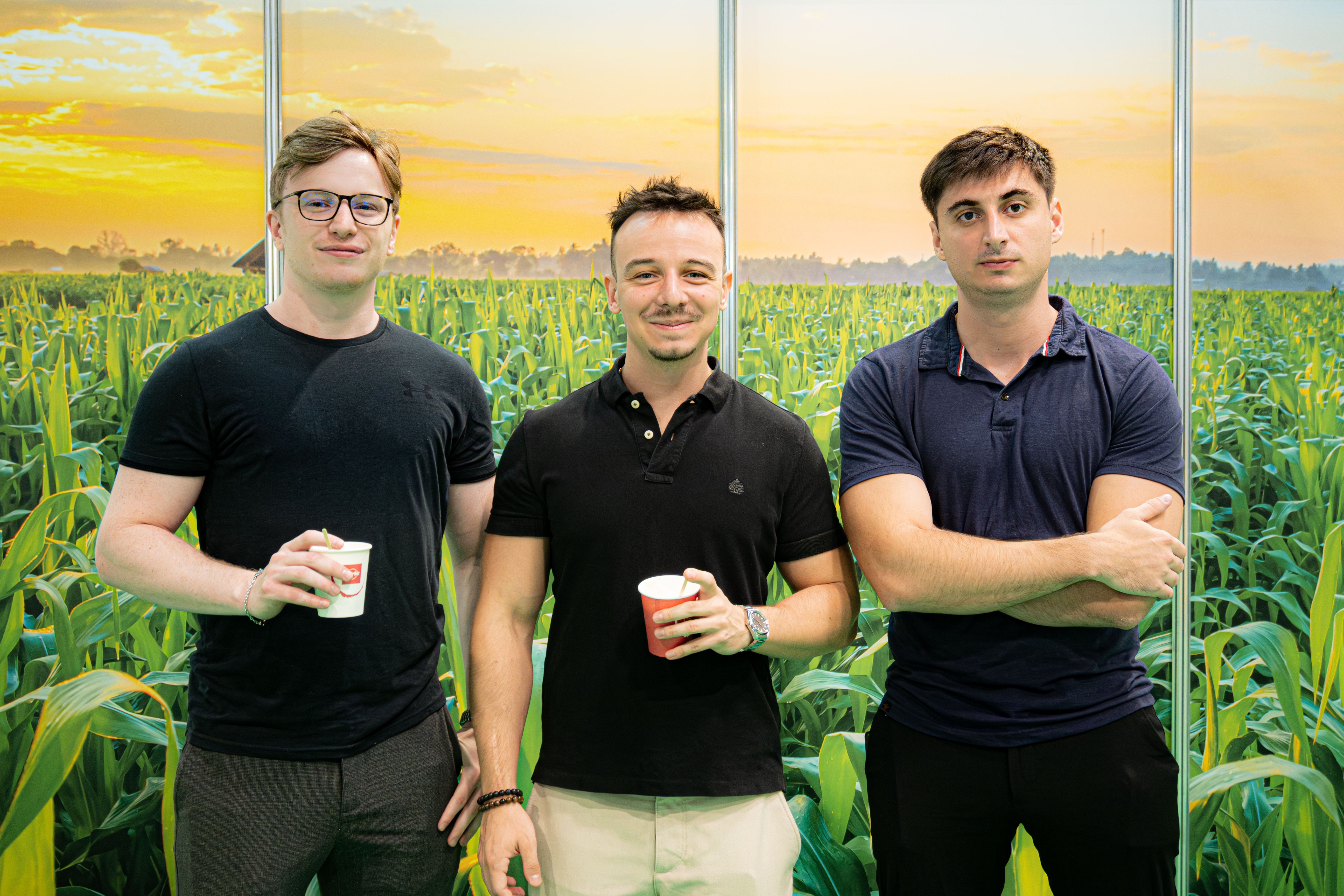
Agro Glance team
Left
Lead Developer
Computer Scientist - ELTE Ex Oracle Engineer
Middle
Machine Learning Engineer
MSc Data Science - ELTE 🏆 3rd / 507 - VIII. National IT Competition, Data Science 16th / 643 - Artificial Intelligence
Right
CEO
MSc Mathematics - Corvinus 11 yrs detasseling ops 250–300 detasselers/season

Over 11 seasons, our founder managed hybrid corn detasseling operations across Central Europe - running crews of 250–300 workers per season, across 9,000+ hectares of certified seed production.

The problem was always the same: you can't physically verify what 250 people did across hundreds of fields in a single day. Supervisors could spot-check maybe 5–10% of the area. The rest was invisible. And when a field inspector found a missed tassel cluster three days later - pollen had already moved. The damage was done.

Every season ended with the same question: what happened in the fields we couldn't see?

That's what Agro Glance was built to answer. The team came together around one problem nobody had solved yet - and built a system that does what no ground crew can: fly every row, detect every tassel, deliver a GPS map the same day.

Not because it's a clever idea. Because we spent over a decade wishing it existed.

Interview with Magyar Mezőgazdaság

Hungary's 78-year-old agricultural magazine and media group.
Agro Glance AI Tassel Detection – Corn Seed
Try for free
Solution How It Works Meet the Team Contact Try for free

AI-Powered Drone Tassel Detection for Hybrid Corn Seed Production

Every missed tassel costs you money. Fly your drones, upload footage, and get comprehensive field purity statistics and error reports in under 2 hours.

Every missed tassel costs you money. Fly → Upload → Get purity stats.

Try for free See How It Works
The Solution

Ready to see what’s happening on every acre you manage?

Full Field Visibility: Monitor every single acre of your land. We scan 100% of your fields so you instantly spot detasseling errors.
2-Hour Results: Speed matters. Get actionable maps within 120 minutes so you can stay ahead of the pollination window.
Accuracy Guaranteed: Our AI is trained on millions of tassels to provide reliable detection you can count on.
Send Crews Right to the Problem: Open the interactive map to view field purity stats and pinpoint exact issue areas, so you know where to deploy your crew.

Eliminate the risk of missed field issues

See How It Works
45M+ Tassels detected
3,500+ ha Fields processed
65+ Hybrid varieties
7 Countries Live environments
How It Works

Three steps. Same-day results.

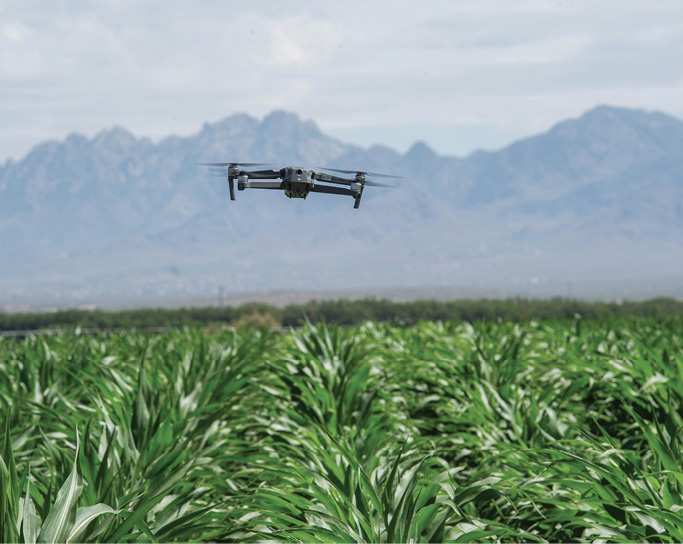
Drone flying over corn field at 12m altitude
Step 01

Fly your drone at 12m altitude

No overlap needed. Standard flight, standard equipment - about 2–3 minutes of drone time per hectare.

Uploading drone images to Agro Glance platform
Step 02

Upload images to the platform

Drag and drop your footage. AI processing starts automatically - no manual analysis, no configuration needed.

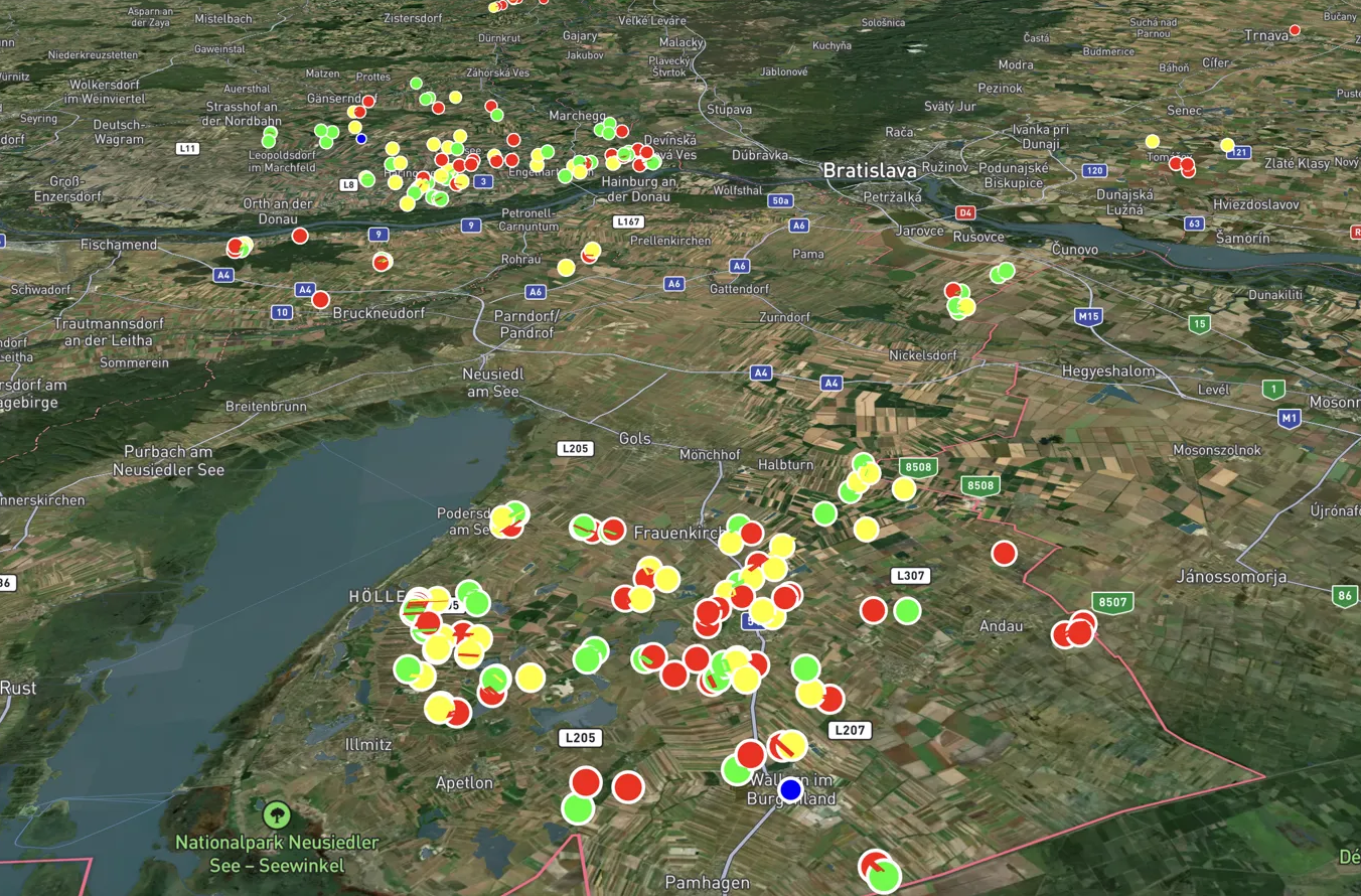
GPS map with tassel detection results
Step 03

Get your stats in under 2 hours

Same-day results. Access full field purity statistics and error reports - crews know where to go before the day starts.

Try for free

Built by people who actually worked on the fields.

11+ years detasseling operations 3,000+ detasselers managed
Agro Glance team

Frequently Asked Questions

You fly your drone at 12m altitude - no image overlap needed, about 2–3 minutes of flight time per hectare. Upload the images to our platform. AI processes everything automatically and delivers a GPS map of every undetected tassel in under 2 hours. No manual analysis, no configuration - hands-off after upload.
Agro Glance is a detection platform - you bring your own drone or existing drone operator. In Central Europe (Austria, Slovakia, Croatia, Hungary), we also offer full-service drone operations as an add-on. Outside this region, we focus on the platform and can connect you with local operators if needed.
In Central Europe we also recruit and deploy detasseling crews - 500+ workers selected from 3,000+ annual applications. Available as an add-on for operations in Austria, Slovakia, Croatia, Hungary and neighboring countries. Outside this region, the detection platform works with your existing crews.
All field data is confidential. You control access and can export documentation at any time for audits, export reviews, or internal quality processes. We operate under strict NDAs with all commercial partners and never share client field data with third parties.

Try Agro Glance for free

Answer a few quick questions and we'll get back to you within one business day.

Works with any standard consumer drone

You'll hear from us, not a CRM.